
Will you chip in to support our nonprofit newsroom with a donation today?
Yes, I want to support My MLTnews!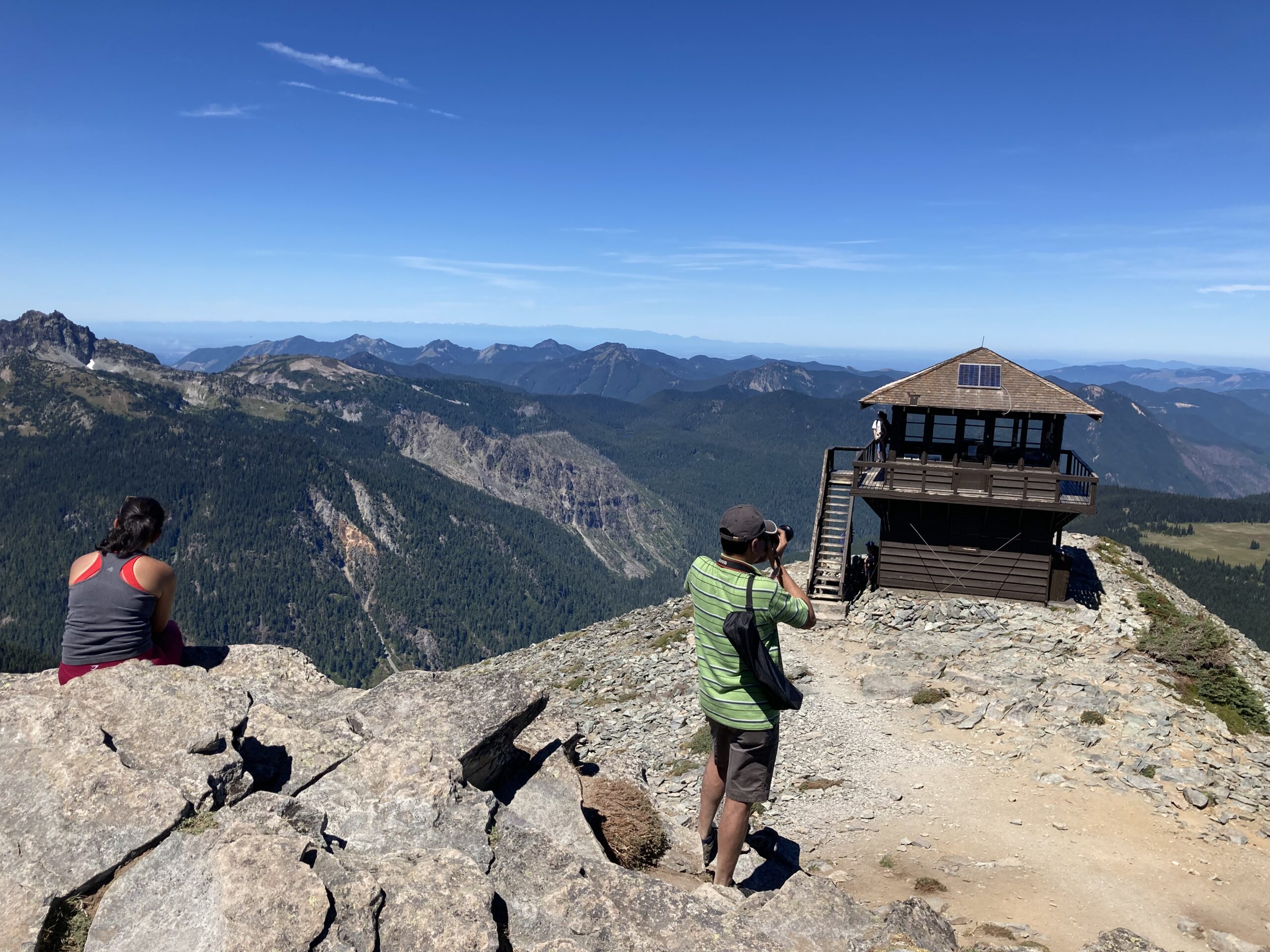
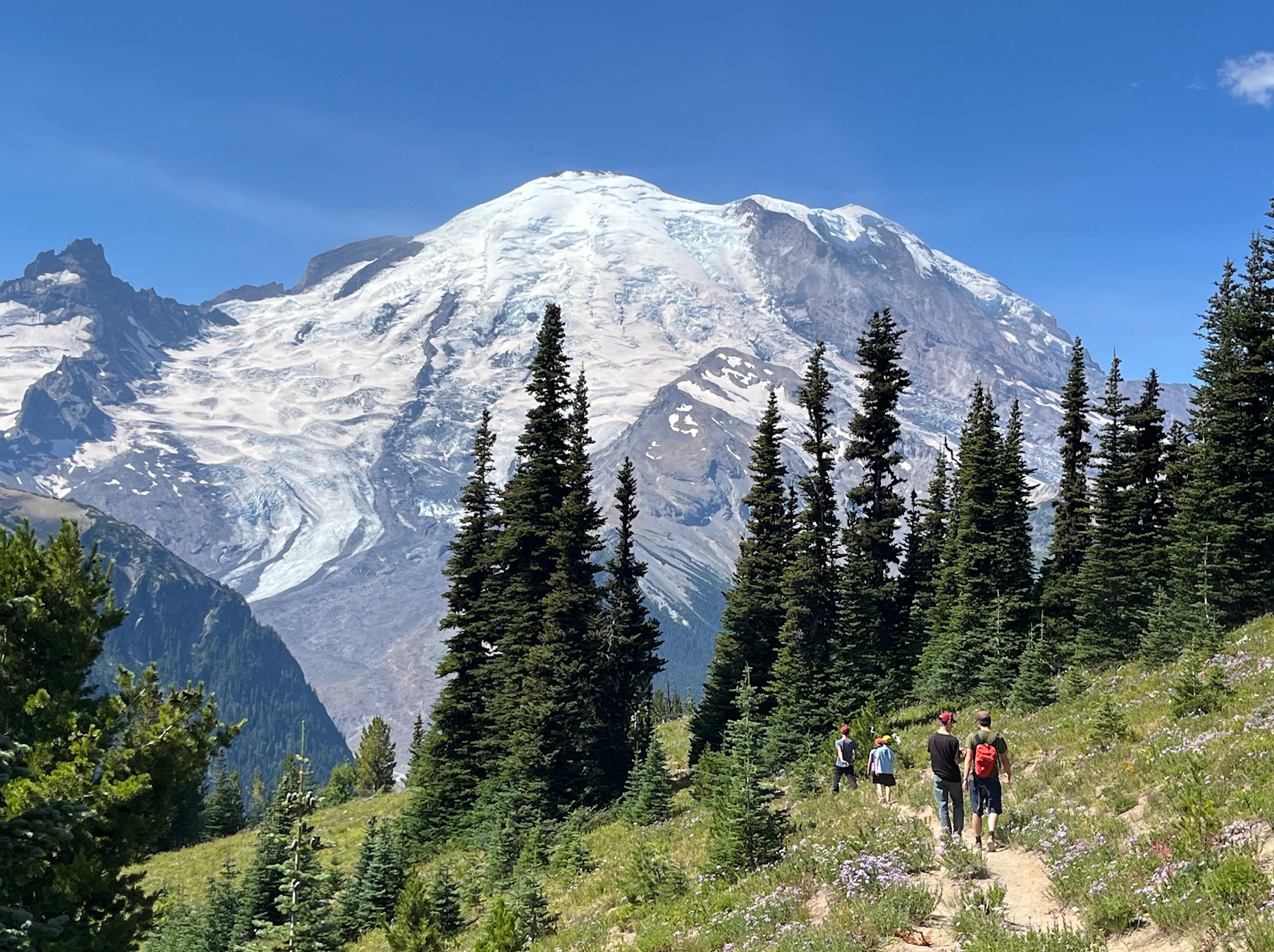
Sunrise is the highest point you can drive to in Mount Rainier National Park. At 6,400 feet elevation, it is 1,000 feet higher than Paradise, where so many visitors go. Sunrise rewards you with a truly breathtaking view of 14,410-foot Mount Rainier from its east side – and the mighty Emmons Glacier cascading down from the summit. This glacier is the largest in the contiguous U.S., covering 4.3 square miles.
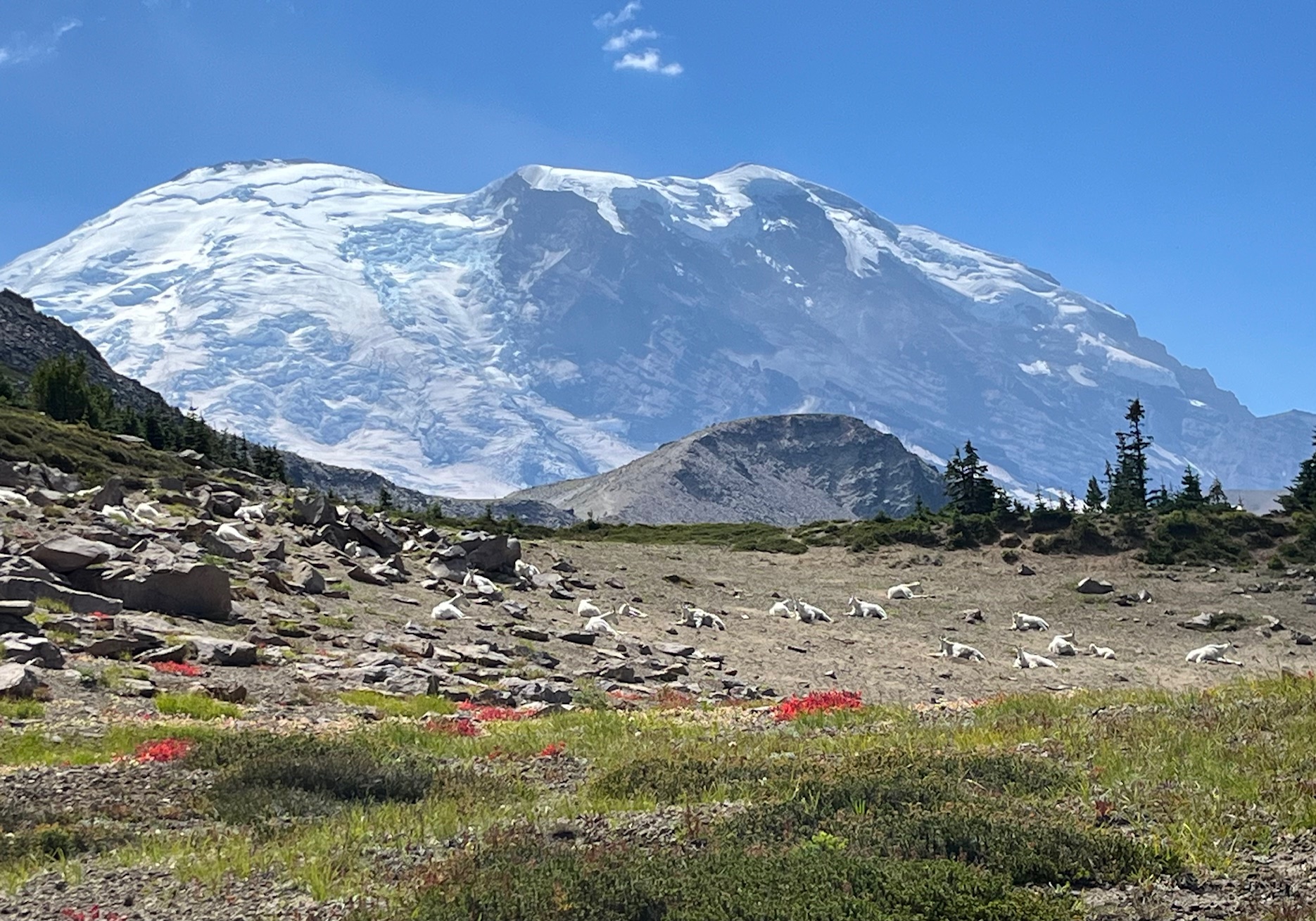
On a recent day hike, Sunrise also rewarded me with a surprise view of mountain goats. A herd of about 20 goats was resting just past Frozen Lake. A park ranger kept us hikers safely watching from the trail and explained there are several herds comprising more than 100 mountain goats total within the national park. He said these goats were mostly laying down because of the 85-degree, midday heat. This was the first time I have ever seen mountain goats on Mount Rainier.
A day trip to Sunrise has several advantages over popular Paradise on the park’s southwest side. It is about an hour drive shorter, and the visitor facilities and hiking trails are less crowded. Sunrise’s facilities are smaller: There is the Sunrise Visitor Center and Sunrise Day Lodge, but no overnight accommodations such as the Paradise Inn.
Sunrise is reached by the White River entrance on the east side of the national park. Visitors need a timed-entry permit through Labor Day, then only on weekends until the season’s end (early to mid-October).
The Sunrise Road is closed in winter and opens in late June or early July, determined by the amount of winter snowfall. Driving up the road, turn off at White River Campground if you have reserved a spot for an overnight stay. This is the only place for tent and vehicle camping (other than wilderness camps that require a permit). It also has a day picnic area.
Continuing up Sunrise Road, pull off at Sunrise Point for a nearly 360-degree view of the surrounding valleys, Cascade Mountains and Mount Rainier. Then drive on to Sunrise at 6,400 feet for an even closer view of the mountain and magnificent Emmons Glacier.
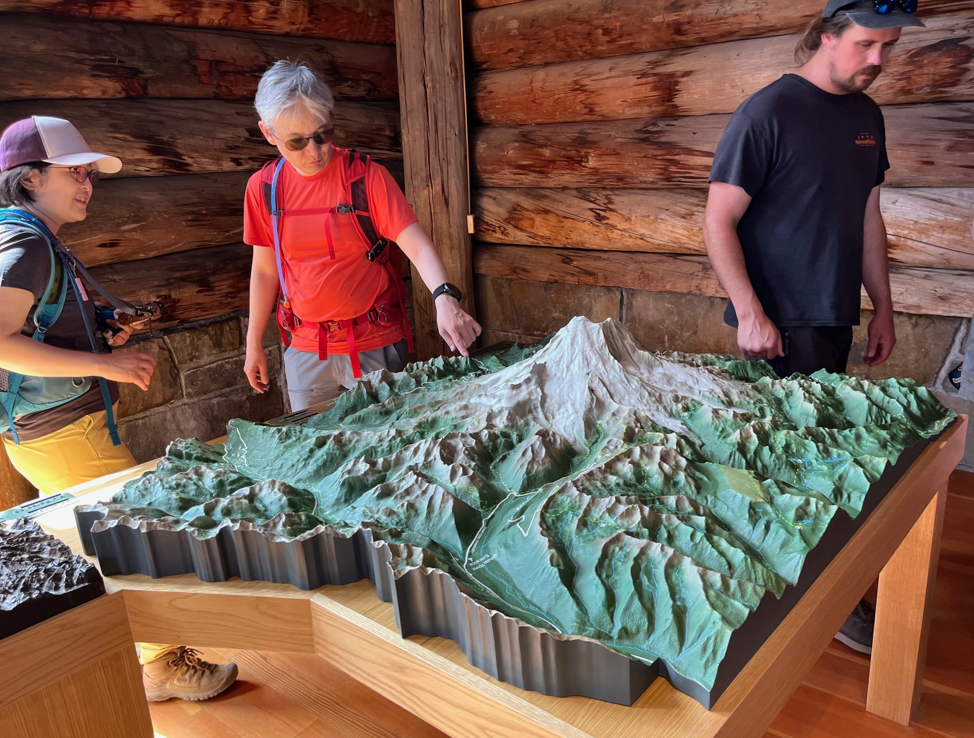
Head for the Visitor Center first. It features informative exhibits, a great topographical map of the park, and helpful park rangers to answer questions. Ask about their guided interpretive programs.
The Sunrise Day Lodge offers a gift shop and take-out lunch items and beverages to eat in the nearby picnic area. All the hiking trails start near the day lodge or just across the parking lot from it. Get a free trail map at the kiosk by the Day Lodge or at the Visitor Center.
For a short, easy hike nearby, take the Emmons Vista Trail, which leads to the Silver Forest Trail. The first features two dramatic viewpoints of the entire Emmons Glacier. The second is a level walk through a subalpine meadow and old burned area. The Silver Forest is so named for the charred tree trunks bleached white by the elements over time. This hike is two miles roundtrip and ideal for families, especially those with younger children.
The meadows at Sunrise once attracted the indigenous Yakama people for summer hunting and gathering. Today they abound with wildflowers such as scarlet and magenta paintbrush, alpine and cascade aster, lupine, bistort and pasqueflower.
More ambitious hikers have a range of trails to consider; some are loops and others out-and-back. The Sourdough Ridge Trail is the “backbone” from which many of these trails begin. All the trails offer eye-popping views of Mount Rainier and the surrounding mountains.
The Frozen Lake Loop Trail and Shadow Lake Loop Trail are each three miles roundtrip. The first offers scenic views as you climb steadily to Frozen Lake (which has thawed by August). The second takes you through wildflower meadows and overlaps with a small portion of the famous Wonderland Trail that encircles Mount Rainier.
From Frozen Lake, you can go north on the Mount Fremont Lookout Trail or south on the Burroughs Mountain Trail. The first takes you 1.3 miles to a historic fire lookout, built in 1934 and one of four remaining in the national park. This is a rocky trail with almost no shade opportunities.
The Burroughs Mountain Trail climbs steadily through some forested areas before you hike up the exposed, rocky flank of First Burroughs Mountain. It’s worth continuing just over a half mile to Second Burroughs Mountain, which has an even more impressive view of Mount Rainier. Total, the hike is 2.6 miles roundtrip from Frozen Lake.
For more information: www.nps.gov/mora/planyourvisit/sunrise.htm
Timed entry permit: www.recreation.gov/timed-entry/10101917

Julie Gangler is a freelance writer who has worked as a media relations consultant for the Snohomish County Tourism Bureau. She began her career as a staff writer at Sunset Magazine and later was the Alaska/Northwest correspondent for Travel Agent Magazine.

Real first and last names — as well as city of residence — are required for all commenters.
This is so we can verify your identity before approving your comment.
By commenting here you agree to abide by our Code of Conduct. Please read our code at the bottom of this page before commenting.