
Will you chip in to support our nonprofit newsroom with a donation today?
Yes, I want to support My MLTnews!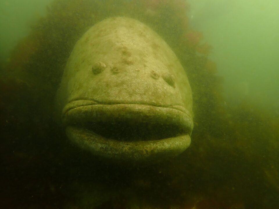
This is the first installment of a new monthly column about the Edmonds Underwater Park.
You never know what you’ll meet underwater in Edmonds — flora, fauna, even old cannons and shipwrecks. There definitely is a lot to see, which is why 25,000 divers visit Edmonds’ Underwater Park each year.
At low tide, the park covers about 27 acres (even more at high tide) off Brackett’s Landing North, going west from the jetty. Around the perimeter of the park, an additional six-acre “exclusion zone” prevents boaters and fishermen from disturbing the wildlife and divers.
Navigating the Park
Navigation is tricky for divers in the Salish Sea, as we have plankton blooms in spring and summer, high wind and waves during winter storms and flooding from the Snohomish River in the spring from snow melt.
At high tide, the water in the park can be as deep as 40 feet. It’s like driving in fog, and you need to go slowly to puzzle out what you are seeing. It’s easy to get disoriented underwater, and visual cues don’t always help in navigating murky waters, so divers use landmarks, rope lines and buoys as references to get their bearings.
City planners deal with a lot of challenges when they design a community, but civil engineering on land is a cakewalk compared to laying out a city underwater.
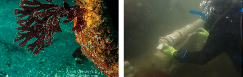
The trails wind their way through a complete ecosystem of plants and sea creatures. You can read more about the flora in the article, A beautiful Edmonds garden you might never see.
By the way, GPS doesn’t work underwater! Divers still need compasses to navigate the park (though now compasses can at least be digital).
Building the park
In 1979, after building the Fishing Pier in the Port of Edmonds, the State Department of Fisheries added a mitigation reef underwater at Brackett’s Landing North to focus the diving area north from the ferry and fishing areas. (Except during maintenance, divers are not allowed near the ferry because of obvious hazards.)
At first, the new reef (called The Enhancement) created confusion, because divers had to swim around it, so in 1982 the City of Edmonds placed an underwater landmark to the west — a wooden ship hull called the Fossil (formerly the Foss 16, with the 6 turned into an L). The hull was placed at a depth of 28 feet.

The idea was to attract divers farther north, away from the Ferry Terminal; ultimately, the Fossil became an interesting destination in its own right, but like all wooden structures in water, the Fossil is almost gone now, eaten by worms and degraded by waves, time and water.
Reuse, Recycle and Repurpose
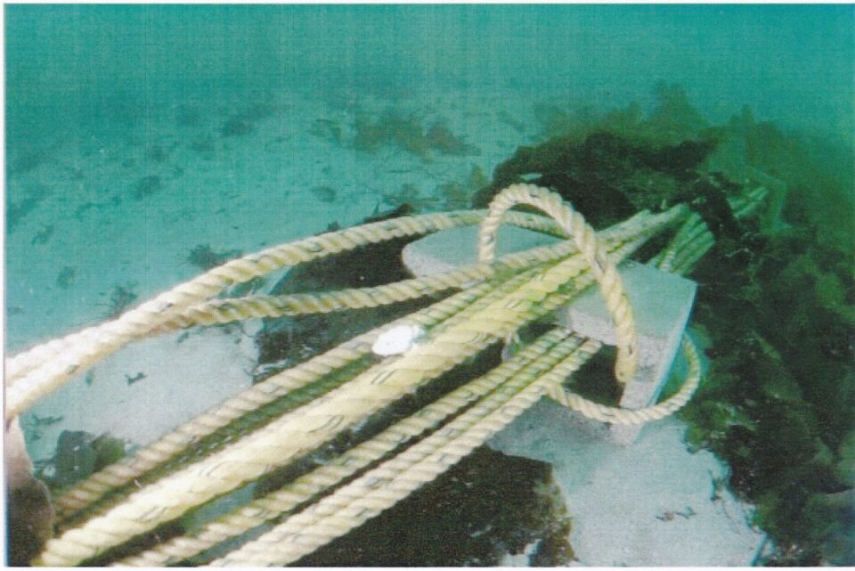
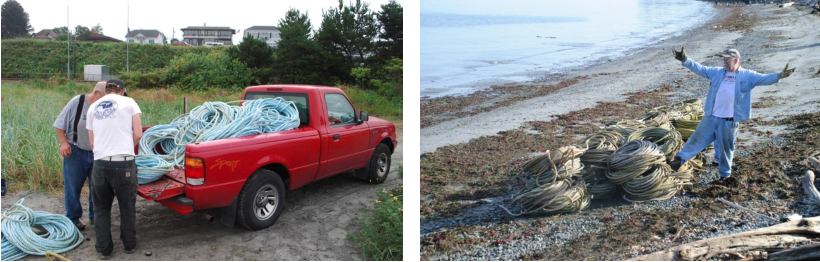
We rely on donated line (what landlubbers call rope) with concrete blocks on the sea floor keeping the lines in place and buoys on the surface marking the intersections.
One of our silver-tongued stewards connected with the captains of two crab boats on The Deadliest Catch. The crabbers replace their crab pot lines frequently, and both the Wizard (Capt. Keith Coburn) and the Rambling Rose donated their old line to the Underwater park, saving it from the landfill.
This lighter 3/4-inch diameter line is much easier to use than the previous heavier, fatter 3-inch donated line, which was too bulky to thread through the concrete blocks we used to hold it. Over a decade we managed to collect about 20 miles of 3/4-inch line.
We mix floating and sinking lines in the dive park to create trails on the sandy bottom, with the hope that the floating ones are easier to spot by the divers. The lines are beautiful, because Red Algae grows on them, hiding the lines and leaving red paths to follow.
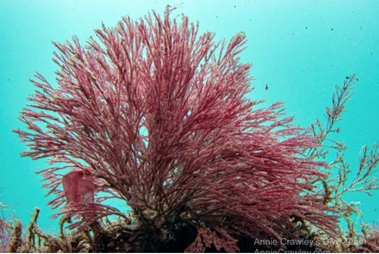
The algae is pretty, but other clingy creatures like barnacles are more destructive than beautiful. We try to clean the lines before they get buried by sand, but ultimately, they have to be refreshed like resurfacing a road.
The lines on Jetty Way, the trail west from the jetty, have been refreshed eight times!
Other donated line includes some from a boom system used for hydroplane races at Seafair in Lake Washington and 3.5 miles of former mooring lines from NOAA.
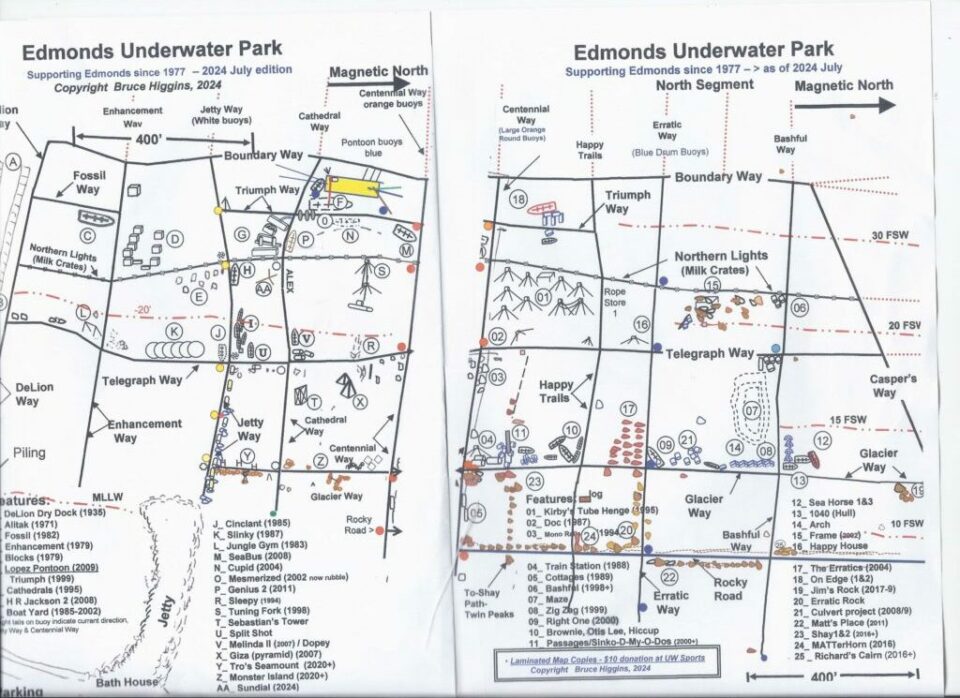
Did you know Edmonds had a subway? In 1978, we placed some short line along the bottom to help us locate the anchors for the Park’s boundary buoys and called it the Edmonds Subway System. We later changed the North and South Subway names to more descriptive titles that you can see on the maps above.
On land, both heavy and light lines are heavy.
All the coils of line are huge, heavy and bulky to move. For easy access, we create underwater storage sites throughout the park and fetch the lines as needed. Concrete blocks hold the lines in groups of about 5 x 200-foot coils; we rarely use more than five coils for a day’s project.
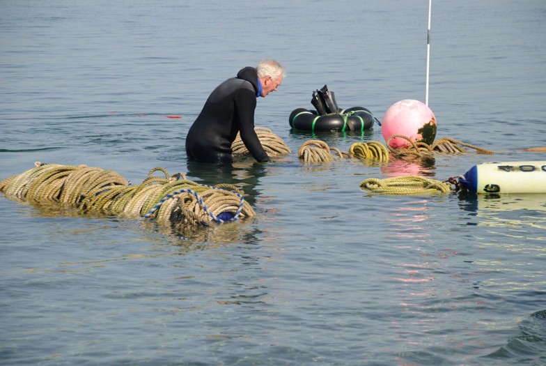
Keeping the line coiled up allowed us to then shuffle it from storage to the project area without too much work.
Adding a trail system to the Underwater Park has improved navigation both for visitors and park stewards. The project is 100% volunteer-driven — no staff and no budget – but over five decades, we have managed to create an underwater sanctuary — a protected habitat for people and sea creatures alike.
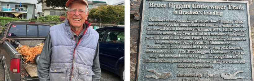 Bruce Higgins
Bruce Higgins got involved in diving in 1970 at the University of Michigan, earning a degree in oceanography and meteorology, then went on to get a degree from Oregon State University in ocean engineering. He moved to the Seattle area in 1976 to teach at Shoreline Community College. In the ’80s and ’90s he worked on the Exxon Oil Spil as a research diver. He has overseen the Edmonds Underwater Park since 1977.

Real first and last names — as well as city of residence — are required for all commenters.
This is so we can verify your identity before approving your comment.
By commenting here you agree to abide by our Code of Conduct. Please read our code at the bottom of this page before commenting.